
Feds Speed Development of Arctic Oil Spill Response Maps

Thursday, February 09 2012
As shipping and energy exploration increase in the Arctic, so do the chances of an oil spill. On Tuesday, the federal government bumped up the deadline for a project that will help responders coordinate if an oil spill ever does happen.
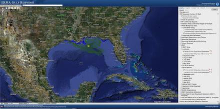
The Environmental Response Management Application or ERMA is basically Google Earth in your web browser. There are a bunch of data layers that can be switched on and off that show information like where drill rigs are located, how thick the ice is and where there’s critical polar bear habitat. All of the information is displayed on a single map, so responders don’t have to call the oil companies, then the weather forecasters, then the biologists, all they have to do is click a box.
The Arctic version is still in development, but ERMA was used in the Gulf of Mexico during the Deepwater Horizon oil spill. Amy Merten is Chief of the Spatial Data branch of the National Ocean and Atmospheric Administration. She says they were working on the Arctic version before Deepwater Horizon, but had to shift focus for a couple of years.
“Arctic ERMA actually benefitted because we took all of the rapid development that we did while we were working on the Gulf spill and applied it back to our Arctic ERMA project when we were able to start working on it again.”
Merten says NOAA already has a lot of the more common datasets like weather and bathymetry, but they’re still working on a few Arctic-specific ones.
“Subsistence fishing areas or use areas were identified. Those we do not have incorporated into Arctic ERMA right now. We’re working with Arctic communities to do that in a manner in which they would like to do that.”
NOAA is working with the Bureau of Safety and Environmental Enforcement to get the Arctic project online by June of this year. That’s right around the same time Shell Oil would start exploratory drilling, if they receive all the necessary permits.
You can check out Gulf ERMA here.

